
Which is the world’s most dangerous animal? If you thought of snakes or scorpions, think again and think smaller. This notorious position is held by an insect that is not even the size of a paperclip – the mosquito. Mosquito-borne diseases kill 1 million people every year. So, how is spatial data science involved in creating a solution to this problem? Let’s find out.
But first, let’s understand what is Spatial Data Science. Then, we’ll move on to where and how to apply Geospatial data. We’ll look at specific use cases from three segments: Health, Urban Planning, and Conservation.
Table of Contents

What is Spatial Data Science?
Geospatial Data Science, also known as Spatial Analysis or Spatial Data science lies at the intersection of geographical solutions like Geographic Information Systems (GIS) and Data Science.
Spatial Data Science Definition

According to Gramener’s Senior Data Science Engineer, Sumedh Ghatage, Geospatial Data Science is a subset of data science, that comprises location analytics, satellite imagery, remote sensing, analyzing projection systems, and analyzing raster and vector data. Keeping Geospatial analytics as a base, we apply these techniques to explore insights from spatial datasets. The major part of it is to focus on the unique characteristics of Geospatial data.
Furthermore, the focus is also on exploring the reasons for the insights. For example, if there has been heavy rainfall in a terrain area for the past few years, what’s the reason for it. We can get answers by identifying the relationship between climatic conditions and their impact.
Some might confuse Spatial Data Science with Geographic Data Science. However, the latter is yet to evolve and currently is a data-driven exercise that combines Geography or Geoscience.
While GIS tells you where something is happening, data science helps you fill in other blanks like what is happening, why it’s happening, and how. Data science uses special characteristics of spatial data in conjunction with other datasets to model answers to these questions.
Spatial Analytics Solutions
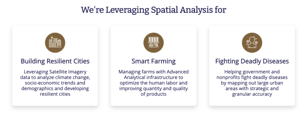
Since the combination of Geospatial and data science can solve most business problems, enterprises and nonprofits are ramping up investments in Geospatial data science projects. Spatial analysis is contributing towards planet-saving activities such as building urban resilience, crop yield prediction, population density analysis for disease mapping, and more.
Did You Know?
About 68% of organizations are likely to increase their investment in spatial data science in the next two years, according to a global survey of 150 thought leaders in various enterprises across verticals.
Check out Gramener’s spatial analysis and AI solutions
In this article, we’ll also be briefly discussing spatial data science and the solutions we developed for non-profit organizations.
Why Spatial Data Science is Growing?
One major factor is the versatility of GIS data. Most common business problems can be converted into geospatial problems. Furthermore, by applying data science, such spatial analysis techniques can be modeled into business solutions.
GIS data, the use of which was restricted to cartographers or geospatial specialists in the past, is now being used by data scientists too. The arrival of several Python packages for geospatial analytics, such as GeoPandas, has also brought spatial data science applications into the mainstream.
Know what contributes to the rise of Geospatial AI and makes it big in the industry.
Role of Spatial Data Analysis in Solving Real-World Problems
Now that we have defined spatial data science and technology, let’s see how we can use this to solve real-world problems. Geographical information is increasingly becoming available not just through satellite imagery but also through IoT devices, GPS trackers, geo-tagging data, and so on.
We can combine this with datasets like infrastructure, population density to get a more comprehensive view. This data is then fed into data science algorithms to determine the solution to the problem.
Here are a few unique Geospatial analytics use cases:
| Spatial Data Science Use Cases |
|---|
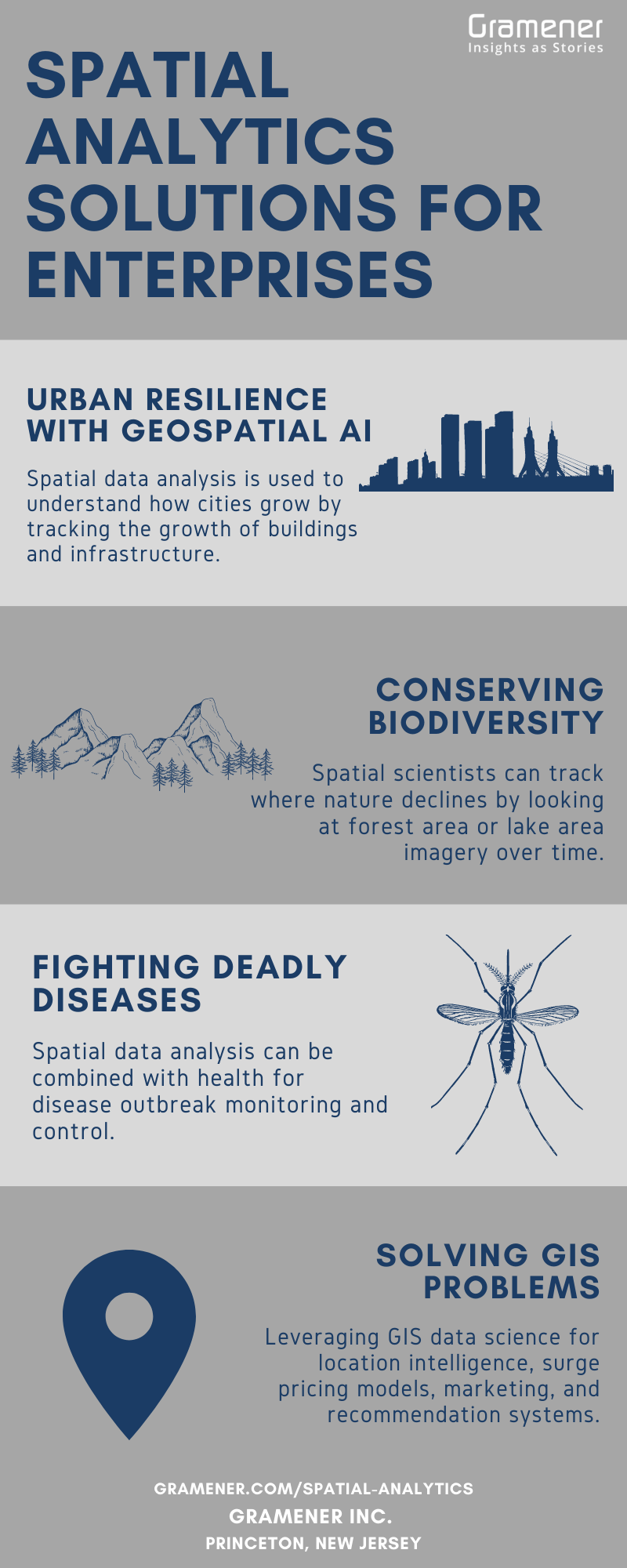
| Spatial data analysis is used to understand how cities grow by tracking the growth of buildings and infrastructure. |
| Experts can assign risk scores to areas for planning and recovery in case of environmental disasters. |
| Spatial scientists can track where nature declines by looking at forest area or lake area imagery over time. |
| Spatial data analysis can be combined with health for disease outbreak monitoring and control. |
| Leveraging GIS data science for location intelligence, surge pricing models, marketing, and recommendation systems. |
| Merging spatial data and Landsat data with Machine Learning model to predict crop yield and enable smart farming. |
The examples listed above just scratch the surface in terms of the possible applications of this emerging technology. So, let’s pick up three geospatial data science projects that we have implemented for our clients to show you what spatial analytics can achieve.

Our Geospatial Data Science Projects for Better Tomorrow
As mentioned earlier, let’s study three use cases Gramener built by partnering with not-for-profit companies.
By using several spatial data visualizations and spatial data science tools such as Geopandas, QGIS, PostGIS, Apache Spark, D3, and more we’ve completed successful Geospatial data science projects.
Health Project: Saving Lives With Satellite Imagery
Mosquitoes kill over 1 million people worldwide every year. Gramener developed a Spatial Analytics solution to fight dengue for the World Mosquito Program (WMP) to control deadly mosquito-borne diseases like dengue and malaria. We identified it as a classic spatial data science problem.
The Success Story
In the lab, WMP introduces Wolbachia bacteria into mosquitoes, modifying them to neutralize their disease-carrying capabilities. Biologists release mosquitoes into targeted zones, where they mate with the local mosquito population. This neutralizes the disease-carrying capabilities of the entire mosquito population’s overtime.
Modifying mosquitoes is a complex process with high costs and weeks of effort. Hence, one of the biggest challenges in this exercise is identifying with precision where to release these mosquitoes. This is where Gramener came in.
Funded by Microsoft AI for Earth, Gramener’s spatial data science solution predicts population density from satellite imagery. It recommends a neighborhood-level intervention plan to identify mosquito release spots and come up with a release plan. The solution thus accelerates social impact and helps save lives.
The solution improves planning efficiency by reducing the manual effort required to identify release points from 3 weeks to just 2 hours. It also improves efficiency by 50% throughout the monitoring phase that spans weeks.
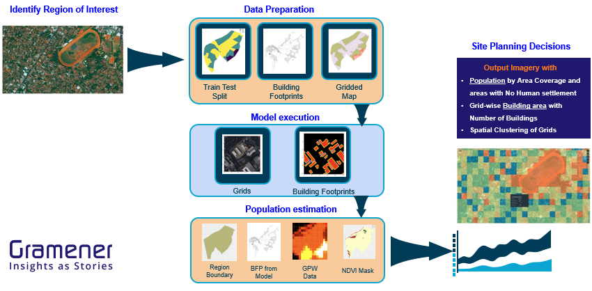
We implemented this solution successfully in Northern Queensland, Australia along with several countries worldwide. Here’s how we went from planning to implementation:
- Identify the region of interest: country and city
- Prepare the data
- Execute the AI model
- Estimate population at a 50X50 meter level
- Get output imagery with
- Population by area coverage and areas with no human settlements
- Grid-wise building area with the number of buildings
- Spatial clustering of grids
Urban Planning Project: Building Resilient Cities with GeoSpatial AI
Temperatures in some urban regions in Canadian cities are higher than in surrounding areas. These Urban Heat Islands lead to effects like heat-related ailments and increased energy consumption.
Identifying these “hotspots” and tracking them is a complicated process as it requires a combination of data and analysis. We believed that it would bring out the value of spatial big data and help us build a solution to build urban resilience.
The Success Story
Evergreen Canada partnered with Gramener under an AI for Earth grant. Gramener factored in datasets like satellite imagery, building footprints, infrastructure, and weather and integrated them.
The AI-powered spatial data science and visualizations tool, built on the Microsoft Azure Stack, offers several capabilities, including:
- Story Mode, which allows users to see data insights as easily consumable stories
- Granular View allows users to get the rooftop temperature of every building in the city
- Scenario Modeling View allows users to simulate a view of the future by modifying various features or climate variables

Municipality stakeholders in The City of Calgary, where the project was piloted, are now able to analyze and plan effective climate interventions and take corrective actions at a micro-level. It helps in creating a resilient city. The solution is scalable and can be rolled out across the country.
Conservation Project: Tracking Biodiversity With Spatial Data Science
Nonprofits and citizen scientists make immense contributions to conservation efforts by tracking, taking pictures, and identifying species of plants and animals. For instance, a frog that had been listed as endangered in Wisconsin was spotted by a citizen scientist, the first one to be documented in over 50 years.
However, the problem is that experts primarily do species identification with manual efforts. This creates a bottleneck in identifying species and in biodiversity tracking efforts.
The Success Story
Gramener partnered with Microsoft under AI for Earth and trained a deep Learning driven neural network to identify plant and animal species. With this geospatial data science project, one can identify over 5,000 species in this manner.
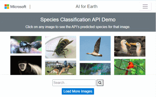
We packaged this exclusive spatial data science solution, made with Microsoft, as an API. It is now available in Microsoft’s public domain. This API allows users to upload an image, and the API returns a list of candidate species, including the scientific and common names. It also specifies the confidence interval for each candidate.
Choose Gramener for Best Spatial Data Science Solutions
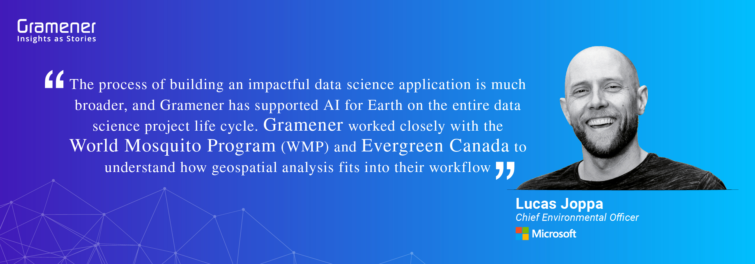
Gramener is proud to be Microsoft’s Gold partner. Together we are collaborating with other impactful organizations to leverage the power of spatial data science. Here’s a word of appreciation from Lucas Joppa, Microsoft’s Chief Environmental Office for successfully completing the spatial data science projects with Evergreen Canada and the World Mosquito Program (WMP).
The intent is to solve big problems facing humanity, wildlife, and the environment. Each of these cases highlights the potential to use the power of analytics and storytelling to change the world.
Contact us for custom built low code data and AI solutions for your business challenges and check out spatial analytics solutions built for our clients, including Fortune 500 companies. Book a free demo right now.