At Gramener, we are on a quest to build innovative and scalable data applications that deliver lasting impact. The Edison Awards are known all over the world for recognizing, honoring, and celebrating innovation and excellence displayed in the design, marketing, and launch of new products. Named after the famous inventor of the light bulb – Thomas Edison, the Edison Awards were established in 1987. In the last week of April, Edison Awards declared the winners of their prestigious honor for the year 2021.
Table of Contents
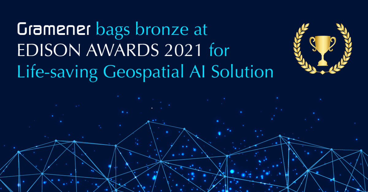
Gramener wins the Bronze Edison Award
Gramener won the Bronze Edison for the Geospatial solution that is developed in partnership with Microsoft AI for Earth’s initiative for the World Mosquito Programme (WMP). The aim of the initiative was to bust the spread of mosquito-borne diseases around the world and save millions of lives in the process.
Download the Case Study: How Gramener helped WMP save millions of lives by leveraging GeoSpatial AI to fight mosquito-borne diseases.
About the WMP Initiative

WMP has been carrying out this activity for years, with impressive results. Several rounds of releases of the modified mosquitoes in a city in Indonesia have resulted in a 76% decline in Dengue cases within a period of 2.5 years. Similar results were observed in different communities across the globe.
Inspired by these results, WMP wanted to scale up its initiative to bring more impact. The goal of the World Mosquito Program is to protect about 100 million people in 12 nations. However, one of the major challenges in doing so was the time and resources required in effectively identifying the far-spread communities that needed intervention.
About 40% of the world’s entire population lives under the threat of contracting potentially fatal mosquito-borne diseases such as Dengue, Zika, Chikungunya, etc. The World Mosquito Program (WMP) is aimed at reducing the spread of such diseases and saving millions of lives across communities all over the globe.
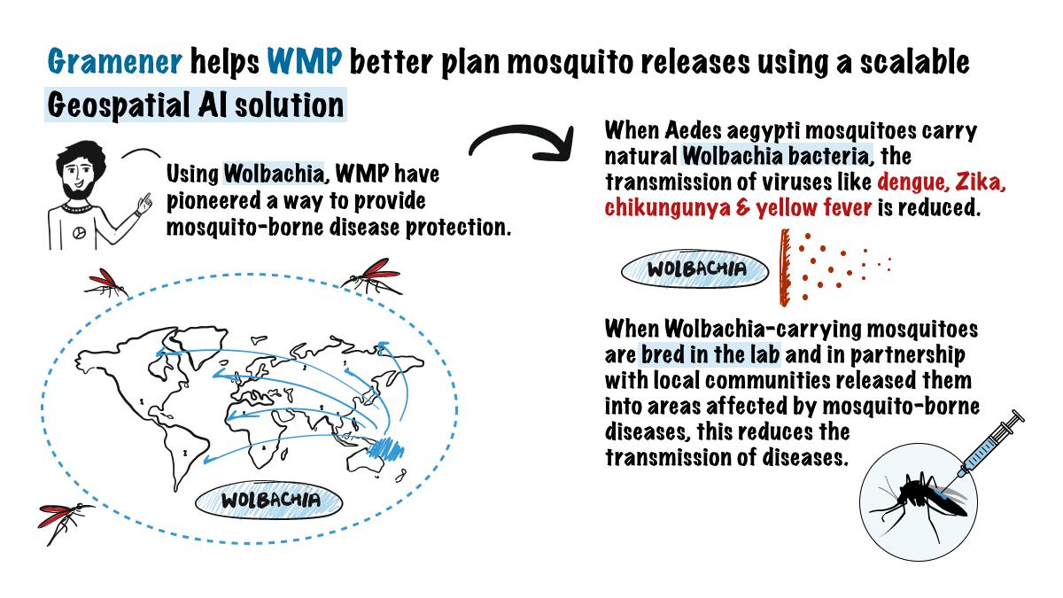
As part of the initiative, WMP has been deploying volunteers who release lab-bred, disease-free mosquitoes in their communities in the Asia Pacific and South American regions. These mosquitoes are bred in a laboratory with Wolbachia-infused cells. Wolbachia is a bacteria that throttles the replication of dengue and other similar disease-prone viruses in a mosquito.
When such mosquitoes are released into the environment, they interbreed with other mosquitoes, spreading the bacteria in an entire population of mosquitoes. Over a period of time, this neutralizes the disease-carrying capabilities of the mosquitoes in that region.
Gramener’s Geospatial Solution solved WMP’s Challenge
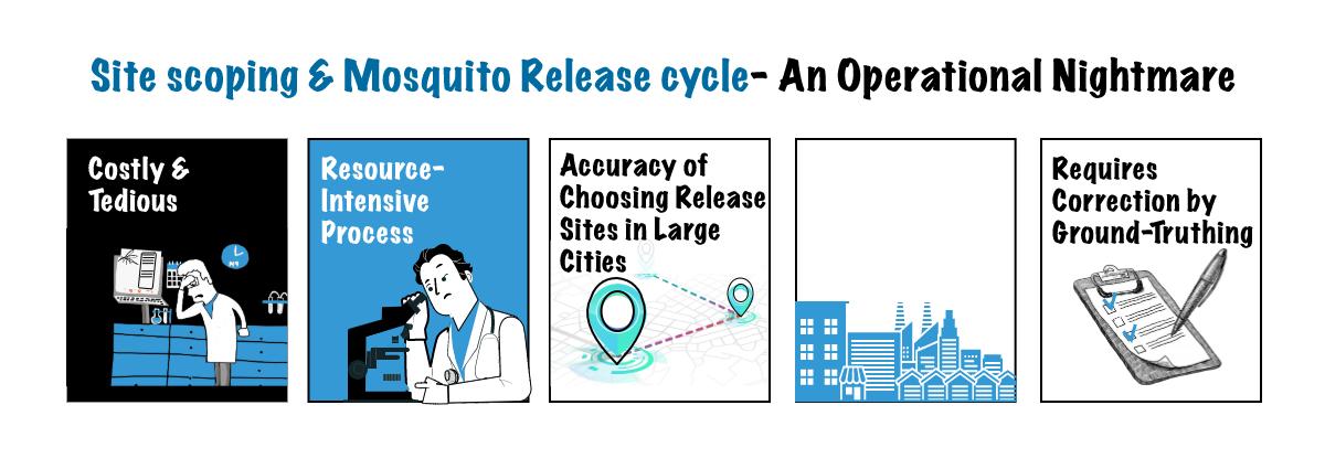
The key to success lay in the accuracy of identifying the release points. But the release points are spread across global geographies. The process of identifying the geographical locations was manual and cumbersome. Because this effort was manual, it also made it time-consuming and expensive. All of this stood in the way of scaling up the program and impacting lives positively.
As WMP’s data science partner, Gramener developed an AI-powered geospatial analytics solution.
This data-driven solution utilizes satellite imagery for accurately mapping different areas at a strategic and granular level. It uses several data variables such as WMP’s existing release point records, human population densities in different communities, weather, industrial sites, and land use to identify release points as close as 100 square meters.
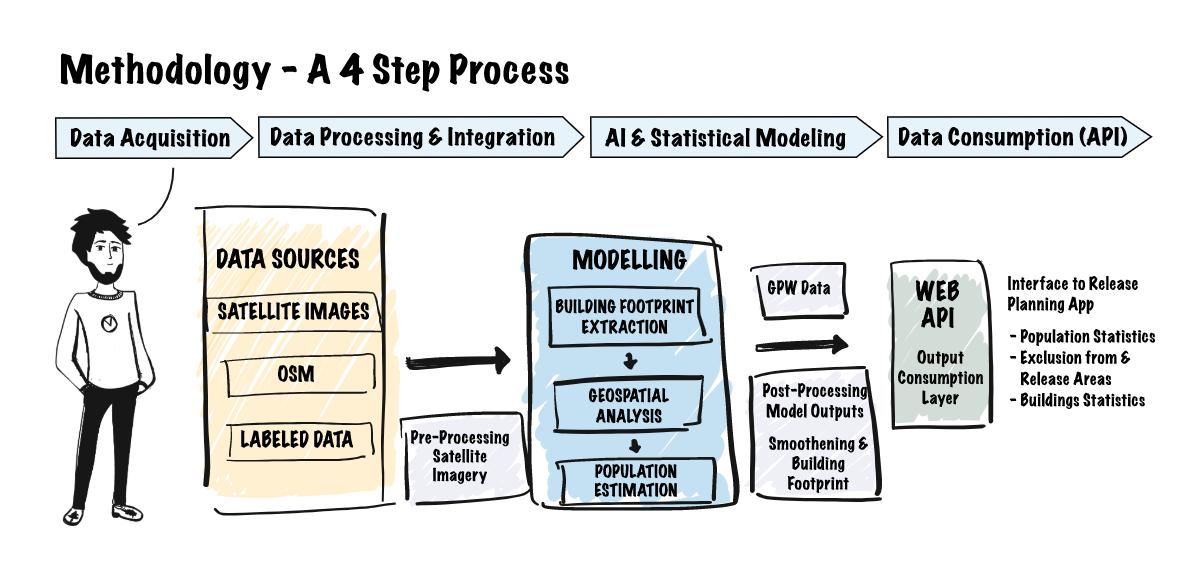
Because these data points are globally available, it makes the solution and the program implementable across the world.
Gramener’s Geospatial solution leverages spatial analysis to:
- Geographically model the problem using satellite imagery.
- Apply data learning to derive results through computer processing.
- Examine those results and provide solutions.
Geospatial Solution Built on the Gramex Platform
Gramener’s award-winning geospatial application has been built on its low-code platform Gramex. It is a PaaS data science platform that uses low-code technology to rapidly develop production-ready data applications. Gramex is perfect for building data applications like this one where the stress is on data exploration and insight generation to aid decision-making. Also, because low-code can rapidly build enterprise-grade data apps, the platform offers the much-needed speed and scalability crucial for such a program.
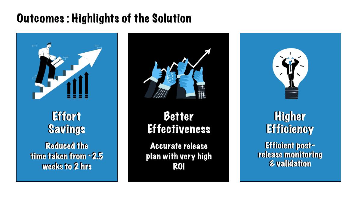
Gramener’s geospatial solution not only allows the program to handle tons of unstructured data but also does so rapidly with granular accuracy. This is why the solution has been able to give a direction to the WMP initiative leading to more than 5 million lives being saved.
Apart from deploying deep learning geospatial solutions for fighting deadly diseases, we build solutions to enable smart farming too. With advanced agriculture technology, we enable AgTech organizations to predict crop yield and quality harvest.